Last updated: August 2026. Route count, distances and the Olle Passport system checked against the Jeju Olle Foundation and its official English guide.
—
Quick Answer: What Is the Jeju Olle Trail?
🎟️ Book Your Jeju Olle Trail Hiking Guide Experience
Skip the queues and language barriers. Compare verified tours, tickets, and rentals for Jeju Olle Trail Hiking Guide on Klook — instant mobile vouchers, English support, free cancellation on most activities.
This jeju olle trail hiking guide covers what a first-timer actually needs. The Jeju Olle Trail is a way-marked walking network that circles Jeju Island, South Korea: 437 km across 27 routes, of which 21 form the connected loop around the island and the remaining six are sub-routes onto offshore islands and inland detours.
Routes average about 16 km, which is a 4–7 hour walking day for most people. You don’t hike all 27 — most visitors pick one to three routes over a two-to-four day trip, in any order. Difficulty is low to moderate coastal walking; no mountaineering experience needed.
The trails themselves are free. The optional Olle Passport, used to collect route stamps toward a completion certificate, costs ₩20,000 in paper form — or you can use the free smartphone app passport instead.
—
Your Complete Jeju Olle Trail Hiking Guide: The 27 Routes at a Glance
The first Olle trail opened in 2007, created by Suh Myung-sook, then editor-in-chief of the news outlet OhmyNews, who came back from walking Spain’s Camino de Santiago wanting something similar for her home island. “Olle” (올레) is a Jeju dialect word for the narrow lane connecting a house gate to the main road — a fitting name for a trail built to thread through communities rather than around them.
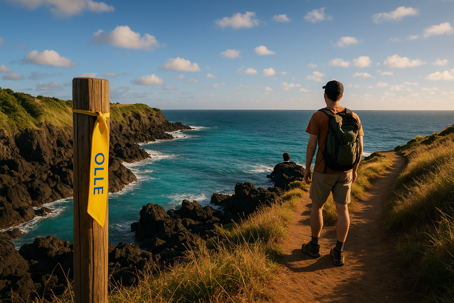
The network is 21 main routes (1–21) plus 6 sub-routes, the sub-routes numbered off their parent (1-1, 7-1, 14-1 and so on). Navigation is by blue-and-orange ribbons tied to posts, stone walls and branches, plus arrows and the ganse (간세) wooden pony markers — Jeju’s trail mascot, and also the shape of the stamp boxes.
Routes run clockwise around the island from Route 1 in the east, with Route 21 closing the circuit back near where Route 1 begins. For planning and the official interactive map, the Jeju Olle Foundation site is the definitive resource — route conditions and detours change, and it’s the only source that stays current.
Route 1: Siheung to Gwangchigi (15.1 km)
Time: 4–5 hours | Difficulty: Medium
Route 1 is where the whole network started and runs along Jeju’s eastern shoreline past the UNESCO-listed Seongsan Ilchulbong (Sunrise Peak). Mostly flat, well-marked, finishing at a coastal beach. A good choice for a jet-lagged first day.
Route 7: Jeju Olle Tourist Center to Wolpyeong (17.6 km)
Time: 5–6 hours | Difficulty: Medium
Consistently the route international visitors rate highest. It starts at the Jeju Olle Tourist Center in Seogwipo, passes Oedolgae — a solitary basalt sea stack — and then hugs the south coast, dipping in and out of small fishing villages. The ocean views are exceptional at almost every turn.
Route 10: Hwasun to Moseulpo (15.6 km)
Time: 5–6 hours | Difficulty: Medium
Route 10 passes Sanbangsan, a dramatic dome-shaped lava mountain, and continues along Yongmeori Coast, a layered tuff coastline that looks borrowed from Iceland. It finishes in Moseulpo town, which is a fine excuse for a seafood lunch at the local market.
Route 18: Old Downtown Jeju-si to Jocheon (19.8 km)
Time: 6–7 hours | Difficulty: Medium
Route 18 starts in Jeju City’s old downtown and works east along the north coast to Jocheon. It’s the most urban start of the four here — handy if you’re based in Jeju City and don’t want a bus ride before you start walking — and it shifts into coastline and village lanes as it goes.
—
The Best Olle Trails for First-Time Hikers
If you have one or two days and haven’t hiked in Korea before, narrow the list to these.
Beginner Pick: Route 7
It starts at the Jeju Olle Tourist Center, so you begin exactly where the information, maps and stamps are. Terrain is mostly flat coastal path, signage is the best on the network, and you finish within reach of Seogwipo’s restaurants and accommodation. Budget 5–6 hours of walking.
Scenic Coastal Pick: Route 10
For dramatic geology rather than crowds. Yongmeori Coast is the highlight — and the reason to check conditions first, because the coastal section closes in high waves. Check the official site the morning before you go.
If You’re Based in Jeju City: Route 18
Starting in the old downtown means no pre-dawn bus. It’s a longer day at 19.8 km, but it’s the easiest route to start on a whim.
Not confident navigating Jeju’s bus system alone? A guided day hike hands the logistics to someone else and usually includes hotel pickup.
Browse guided Jeju hiking tours on Klook →
—
How to Get to the Jeju Olle Trails
Getting There from the Mainland
Jeju International Airport (CJU) is the gateway. Flights from Seoul (Gimpo) take about an hour and run dozens of times daily — it’s one of the busiest air routes in the world, so fares are competitive and schedules are dense. If Jeju is part of a longer Korea trip, our 4-day Jeju Island itinerary shows how the trail days fit around everything else on the island.
Getting Around the Island
Jeju’s public bus network reaches every trailhead, and it’s genuinely usable without Korean — but route numbers and fares on Jeju have been reorganised more than once, and several widely-shared blog bus numbers are now out of date. Don’t trust a number you read in an article, including this one. Instead:
- Put the trailhead into Kakao Map or Naver Map and read the live bus routing. Both work in English and both are accurate about Jeju’s current network.
- The Jeju Bus Info service also lists current routes and timetables.
- Airport limousine and intercity buses connect Jeju City with Seogwipo across the island; local buses handle the coastal villages where most trailheads sit.
Fares are low — most single trailhead journeys run a few thousand won — and a T-money or Cashbee transit card bought at any convenience store works on Jeju’s buses just as it does on the mainland. Tap on boarding, tap off when you get off.
Accommodation clusters in Jeju City, near the airport, and Seogwipo on the south coast. Seogwipo puts you closest to Route 7 and the southern trails; Jeju City suits Route 18 and the north.
—
What to Pack and Wear
The Olle trail is not a mountain trek — but preparation still matters.
Essential gear:
- Trail running shoes or light hiking shoes with grip — lava rock paths are uneven
- Rain jacket. Jeju’s weather turns fast, and the south side gets rain year-round
- At least 1.5 L of water. Convenience stores appear along most routes, but not reliably on all of them
- Sun protection — hat and high-SPF sunscreen. Coastal paths have almost no shade
- Snacks: Korean convenience stores sell kimbap, triangle rice balls and protein bars — our Korean convenience store food guide covers what’s worth grabbing
- Power bank, because you’ll be navigating on your phone
- Trekking pole, optional, useful on muddy inland sections
After a 17 km day, a Korean bathhouse is the correct move — see our jjimjilbang guide for foreigners if you’ve never used one.
What not to bring: a heavy pack. If you’re walking a single route, leave your luggage at your guesthouse — most near trailheads store bags free.
—
Costs, Stamps & the Olle Passport System
Walking the trails is free. Here’s what you might actually spend:
| Item | Cost |
|---|---|
| Olle Passport (paper) | ₩20,000 |
| Olle Passport (smartphone app) | Free |
| Stamps at checkpoints | Free |
| Bus to and from a trailhead | A few thousand won |
| Guesthouse near a trailhead | Roughly ₩25,000–₩60,000/night |
The Olle Passport is a booklet you stamp as you walk. Each route has stamps at its start, midpoint and end, held in blue pony-shaped wooden boxes on the trail. Collect every stamp on every route and the Olle Foundation issues a completion certificate — a genuine goal for repeat visitors, and the reason you’ll see walkers detour to a stamp box they’ve missed.
Passport sales help fund trail maintenance. If you’re only walking a route or two, the free app passport does the same job without the ₩20,000.
Walking every route at roughly one route a day takes about 26 days.
—
The Olle Trail is walking, not climbing. If you want the opposite — granite, stone steps, and altitude within reach of the capital — our Bukhansan hiking guide covers the trail times and access rules for Seoul’s own national park.
Practical Mistakes to Avoid on the Jeju Olle Trail
The mistake that ruins days most often: underestimating the gap between finishing a route and the last bus out.
Rural Jeju buses thin out in the evening, and a trailhead that had a bus every 20 minutes at noon may have one an hour after dark. If you start a 17 km route at 1pm and walk slowly, you can finish in the dark with nothing running. Check the last departure from your finish point before you start walking, using Kakao Map — not a blog.
Other common mistakes:
—
Frequently Asked Questions
How many routes does the Jeju Olle Trail have?
27 in total — 21 main routes forming the loop around the island, plus 6 sub-routes. Together they cover 437 km.
How long does it take to hike the entire Jeju Olle Trail?
About 26 days at one route per day, before rest days. Most visitors walk one to four routes on a short trip, and there’s no requirement to do them in order.
What is the best time of year to hike the Jeju Olle Trail?
Autumn — October and November — is the most popular window: mild, comparatively dry, and good colour inland. April and May are the second-best choice. July and August bring heat, humidity and typhoon risk; midwinter brings cold coastal wind and occasional ice on shaded paths.
Is the Jeju Olle Trail suitable for beginners?
Yes. Most routes are flat or gently rolling coastal paths with no technical sections. The real challenges are distance and sun exposure, not terrain. Routes 1 and 7 are the friendliest starts.
Do I need a guide to hike the Jeju Olle Trail?
No. Signage and ribbon markers are consistent, and the app handles navigation. A guided tour is worth it mainly if your time is tight or you’d rather not deal with buses.
How much is the Olle Passport and where do I buy it?
The paper passport is ₩20,000, sold at Jeju Olle information centres. The smartphone app version is a free download and collects the same stamps.
Can I hike the Jeju Olle Trail in winter?
Yes, with a windproof layer. December to February is the quietest season and clear winter days give the sharpest ocean views. Some trailhead guesthouses close off-season, so book ahead.
Are dogs allowed on the Jeju Olle Trail?
Leashed dogs are generally fine. Routes pass through farmland and villages, so keep close control near roads and livestock.
—
Ready to Hit the Trail?
The Jeju Olle Trail is among the most rewarding walks in East Asia, and it asks very little of you beyond a willingness to keep going. One route or the whole 437 km, the mix of volcanic coastline, fishing villages and open sea air isn’t replicated anywhere else in Korea.
If you’d rather someone else handled the buses and timings on your first day out, a guided Jeju hiking tour covers the logistics with English-speaking support.
Find Jeju hiking and nature tours on Klook →
—
Route conditions, closures and bus routing change. Check the Jeju Olle Foundation before you set out, and confirm bus times in Kakao Map on the day.
Disclosure: SeoulScope is a participant in the Klook and Agoda affiliate programs and the Amazon Associates Program. As an Amazon Associate we earn from qualifying purchases. We may earn a small commission when you book or buy through links in this post, at no extra cost to you. We only recommend experiences and products we believe will genuinely help your trip.
3 thoughts on “Jeju Olle Trail Hiking Guide: All 27 Routes, Costs & What to Know Before You Go”